
Norwich Neighbors by Source
A block question is answered by several public record types, each with a defined scope. MapGeo can show the parcel next door. The Assessor and Vision route can show an assessed owner and a tax-mailing field. A deed shows recorded parties. A permit shows an address event. The voter system can confirm a person-and-town match within its privacy rules. Historical directories show earlier address entries. None of these is a complete list of everyone who lives on a block.
| Source | What It Shows About a Block | Access |
|---|---|---|
| Norwich MapGeo parcel viewer | Boundaries, parcel IDs, owner/card preview, layers, and adjacent parcels | Free viewer with a data disclaimer |
| Norwich Assessor and Vision | Assessed owner, situs, mailing address, values, sale reference, and zone | Free current property lead; staff confirmation for record questions |
| Norwich City Clerk land index | Grantors, grantees, legal descriptions, instruments, and book/page | Paid subscription or clerk-assisted access |
| Building portals | Permit, inspection, plan-review, and certificate events keyed to an address | ViewPoint and OpenGov; older material may need staff |
| Connecticut voter records | Public registration fields and participation information within statute | Name lookup or authorized file request, not a block export |
| Otis reverse directories | Historical address-to-name entries and community sections | Library, microfilm, scan, or reference assistance |
| Public civic notices | Planning areas, meeting dates, district context, and contact routes | City notices and agenda records, not private rosters |
An owner is not automatically an occupant. A mailing recipient may be an agent or a post-office box. A registered voter is not every household member. A historical directory entry is tied to its printed year. Keep the category and date beside every name, especially when one parcel has an entity owner and an out-of-town mailing address.
The Norwich Neighbor Result
The word neighbor can mean a nearby parcel, a person registered at a nearby address, an owner in the deed chain, or a household known through a local publication. Those meanings should not be merged. A parcel result is strongest for geography. A deed is strongest for a recorded transfer. A voter match is strongest for the released registration fields. A directory or notice can support a historical connection. A person physically present may be absent from all four.
- Parcel
- A mapped unit of land identified by geometry and a parcel or map ID. It is not a household.
- Owner
- The person or entity assessed or recorded in a property source. An entity name does not identify every person behind it.
- Mailing address
- The destination used for tax or owner correspondence. It can be an agent, business office, or post-office box outside Norwich.
- Voter
- A person appearing in the released registration fields for a town. Registration does not list every person at the address.
- Occupant
- A person physically using a place. Public parcel, deed, and voter records do not establish a complete occupant list.
A careful Norwich neighbors result should therefore say what it is: an adjacent parcel, a recorded owner, a tax-mailing destination, a public voter match, or a historical address lead. That wording is more accurate than a single label that implies a complete household finding.
Mapping Norwich Neighbors With MapGeo
MapGeo supplies the most direct block method. Search the street or parcel, select the property, and use the Abutters control. The tool asks for a distance in feet. The selected parcel appears in red, the radius appears in purple, and nearby parcels can be reviewed or adjusted with map clicks. The result can be downloaded as CSV, formatted as Avery labels, or placed in an Abutters Report. The Help material says the report can be taken to town hall for certification.
- Search the Norwich address in MapGeo Property Quick Search and confirm the situs before selecting a parcel.
- Record the parcel ID, owner preview, mailing address, map layer, and date of the view.
- Choose Abutters, enter the feet radius, and select Find. Check that the red parcel and purple radius match the intended block.
- Review each returned parcel separately. Remove or add map selections only when the boundary question calls for it.
- Save the CSV, Avery output, or Abutters Report with the distance and date. Treat it as an adjacency result, not proof of occupancy.
The MapGeo abutters view for a Norwich sample parcel shows the red selection, purple radius, parcel preview, and map layers used for a reproducible block check.
The sample includes a situs, parcel ID, owner, mailing address, value, book/page, and FEMA layer. Preserve the map URL and selected distance because the data and ownership can change.
Norwich Deeds and Permit Events
For a recorded-property layer, use the Norwich City Clerk land index. The subscription screen accepts party name, document type, date range, consideration, instrument number, book/page, lot or block, board or commission, legal-description line, and map number. A result can show direct or indirect parties, recording time, pages, legal description, linked documents, and documents referring to the record. The online service requires a paid subscription, and the City does not publish its online start date. Paper books, images, maps, and certified copies remain a clerk question.
Permit history adds dates without turning the address into a resident roster. Norwich directs applications through ViewPoint Cloud and inspection requests through OpenGov. An inspection request uses inspection type, property address, and permit information. The Building Department warns that older permits may remain on a prior system. Permits, certificates, complaints, and plan reviews can show an address event or structure change, but they do not identify every person using the building.
For each parcel, preserve the situs, parcel ID, legal description, deed reference, permit number, and search date. A street number can change while a legal description stays useful. For a full named-street chain, use the Norwich street directory; a neighbors result remains an adjacency lead.
Norwich Voter Privacy for Neighbors
The Connecticut SOTS lookup is a person-and-town search, not a button for all voters on a street. Its described fields include town, last name, first name, and date of birth for the lookup. A public result may show registration status, party, polling address or place, district, and related election information. Participation history can show whether a person participated in an election or primary, but not the choice made on a ballot.
The Connecticut voter lookup remains subject to current privacy guidance. Public Act 26-1, §96 limits released birth information to the year. A voter who faces a safety risk can use the state privacy process under CGS §9-50d. A complete voter file is a separate CSV request that costs $300, requires a permitted purpose and signed certification, and is not a casual block list. The request route also prohibits personal or private use, harassment, advertising, solicitation, sale, marketing, and display outside the permitted purposes.
For block research, use the free name lookup only to confirm a lawful, specific result. Do not infer that a protected voter, nonregistered person, child, or other household member is absent from the property because the public response is quiet.
Norwich Civic Geography Around a Block
Neighborhood labels can help a search crosswalk a parcel, a directory, and a public notice. They are civic and historic frameworks, not private member lists. Norwich planning material, historic-district records, the Historical Society, and public agendas use different labels for different purposes. The right contact is a public office, meeting record, or archival route, not a request for a private roster.
| Area or framework | Public source or context | Useful contact meaning |
|---|---|---|
| Norwichtown | Historic-district and planning context | Historic address and exterior-change records |
| Little Plain | Historic-district context | Public district and certificate route |
| Chelsea Parade | Historical Society and National Register context | Historic neighborhood search term |
| Bean Hill and Yantic | Planning district and local history | Mill, route, cemetery, and neighborhood vocabulary |
| Greeneville | Planning and neighborhood revitalization notices | Public agenda and planning contact route |
| Taftville | Planning, postal, and directory context | Neighborhood and postal-city crosswalk |
The Norwich agenda center is a public notice route for planning and neighborhood revitalization records.
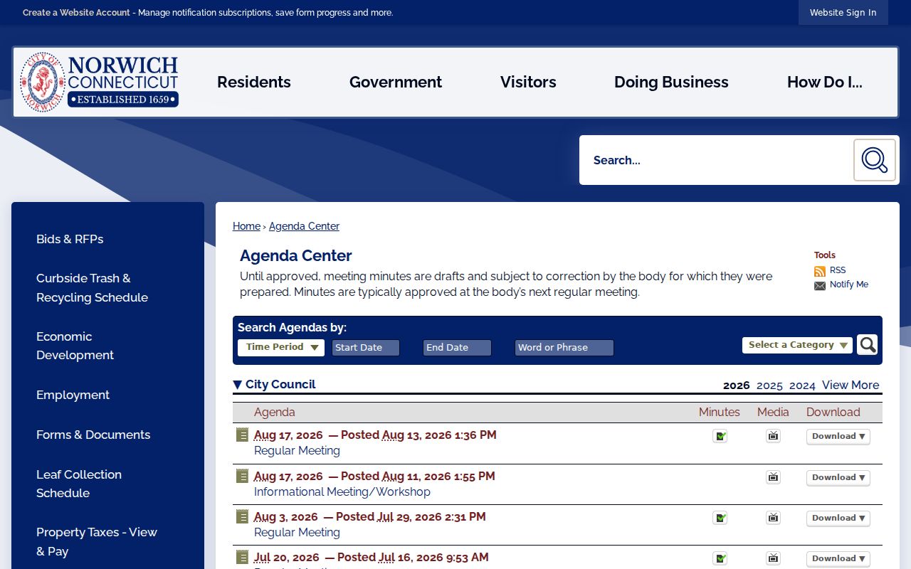
The agenda image supports civic context and contact research. It does not establish who belongs to a neighborhood or who lives on a particular block.
Official Rolls and Neighbor Tools
Official rolls and commercial compiled tools answer different needs. A generic commercial neighbor tool may merge public filings, old directories, marketing data, and user corrections into a convenient profile. It can be stale, blend people with similar names, or omit protected records. The underlying Norwich custodian is slower in some cases, but the field, date, and access rule are visible.
| Source type | Useful strength | Blind spot |
|---|---|---|
| MapGeo and Assessor | Parcel geometry, assessed owner, situs, mailing, values, and map layers | Does not establish complete occupancy or current physical presence |
| City Clerk deed index | Recorded parties, legal description, instrument and book/page trail | Subscription, image, date-range, and privacy limits apply |
| SOTS voter route | Released registration status and town-based voter fields | Not a block export; protected voters and household members may be absent |
| Historical directories and notices | Past names, address entries, community terms, and dated events | Historical information is not proof of a current neighbor |
| Commercial compiled neighbor tool | May collect several public clues in one report | Source, freshness, merge logic, and correction path may be unclear |
Use the official roll that matches the question, then record the source and date. A convenience report can be a lead, but the parcel card, deed, voter result, permit, or public notice should carry the conclusion.
Norwich Public Routes for Civic Contact
No official umbrella directory of Norwich neighborhood associations with public member rosters was located. Congregations, fraternal groups, veterans posts, and block-watch groups may keep private lists. A public contact request should ask for a meeting date, newsletter, archive, agenda item, or general office route. It should not ask for a private list of households.
The Otis Library genealogy collection is a better historical route for older block names, directories, Bulletin material, yearbooks, maps, photographs, cemetery abstracts, and local indexes. The City’s maps and planning records add zoning, precinct, fire-district, and neighborhood context. Public civic information can help identify how a block is described without converting a district label into a claim about private membership.
Preserve the exact notice date, meeting body, neighborhood term, street, and public contact. A later searcher can then distinguish a planning notice from a household record and follow the correct custodian.
Privacy Limits for Norwich Neighbors
Some people will not appear in a public neighbors search by design. Connecticut’s Address Confidentiality Program can give qualifying participants a substitute mailing address and suppress certain voter and marriage-record address details. The SOTS voter privacy process can protect a registration entry after a qualifying sworn safety statement. DMV information is restricted by federal law. Utility customer records, delivery data, private organization rosters, adoption material, protected court files, and household details are not open block fields.
Lawful use. Norwich neighbors records are appropriate for getting to know a block, reconnecting, local history, civic awareness, and personal safety planning. Using parcel or public-name information to watch, threaten, harass, intimidate, or repeatedly contact another person is unlawful and unsafe.
Preserve the result date, feet radius, parcel ID, map URL, selected layer, export name, and record custodian. Ownership, assessment data, voter status, and map layers can change at different times. A dated source log lets a person correct a mistake without treating a stale result as a current fact.